Water Quality Update 07-28-2023

Water Quality Update 07-28-2023 – FAQ

Although duckweed can cover the water surface, it is not algae, and does not produce harmful toxins.

1. Why are weed and algae conditions so frequent this year?

Weed growth in 2023 is in direct correlation from early season water temperatures which began growth early.   The fast and random nature of the storm systems rolling through, keep causing flushes from the tributary streams. Nutrients from these streams are moving into the bay which is causing stronger weed beds in general and with the clarity of the water more dense growth is occurring.  Weeds, many of the Bay viewers are seeing, include many natives and invasive species combined this year. Surprisingly, earlier in the season, regular milfoil, elodea and eel grass.   This past week, the bay turned over which caused a mixing of the water columns. Think of “shaking the Italian dressing bottle.” The previously individualize water columns have now been blended which forced many of the weeds to reach maturity and die. This causes a release of nutrients back into the water, which causes algae to grow and die and then float to the top. Currently, the “nutrient plops = algae” is mixing with break off and floating duckweed.

Certain areas of the bays that are shallower and restricted in water movement do have potential for Cyanobacterial blooms aka Blue/Green Algae.

Cyanobacterial Blooms

How can you help? Run a boat slowly through the area to introduce oxygen and mix the water columns. Oxygen keeps these bacterial strains from growing and multiplying.

2. Are the weeds and striated algal harmful to animals or humans?

The weeds them self and algae that is currently present in many of the areas in Sodus Bay, are not harmful to animals or humans in the nature of medical concerns.
Cyanobacterial Blooms are, if you begin to have an area that looks like a paint spill on the water, do not go in the water or allow animals too. Slowly move the water with a boat or bubbler to introduce oxygen and mitigate growth of the impacted area. https://www.dec.ny.gov/chemical/77118.html

3. How can people get rid of the weeds gathering along their docks and crowding their shorelines?

Short term response to mitigate the algae and weeds from becoming a long term cycle of nutrients from dying plants becoming food for new growth, removal is the best option.  Pull a small amount onto your dock to dry in the sun, then scoop up and apply to flowers or vegetables.  Weeds dry down about 90% and are full of nitrogen. Weeds do not grow well in areas were there is moving water. Regular movement of water and increased oxygen has a lot of benefits.  It will reduce strong weed growth, draw fish and other in water wildlife to eat the weeds. The oxygen will also mitigate algal growth.

Other things that will mitigate weed growth in your immediate waterfront is how you care for your lawn.  Please see Homeowners guide for additional details on strategies: Homeowners Guide for Shoreline Property Owners


Water Quality Updates: Summer 2022

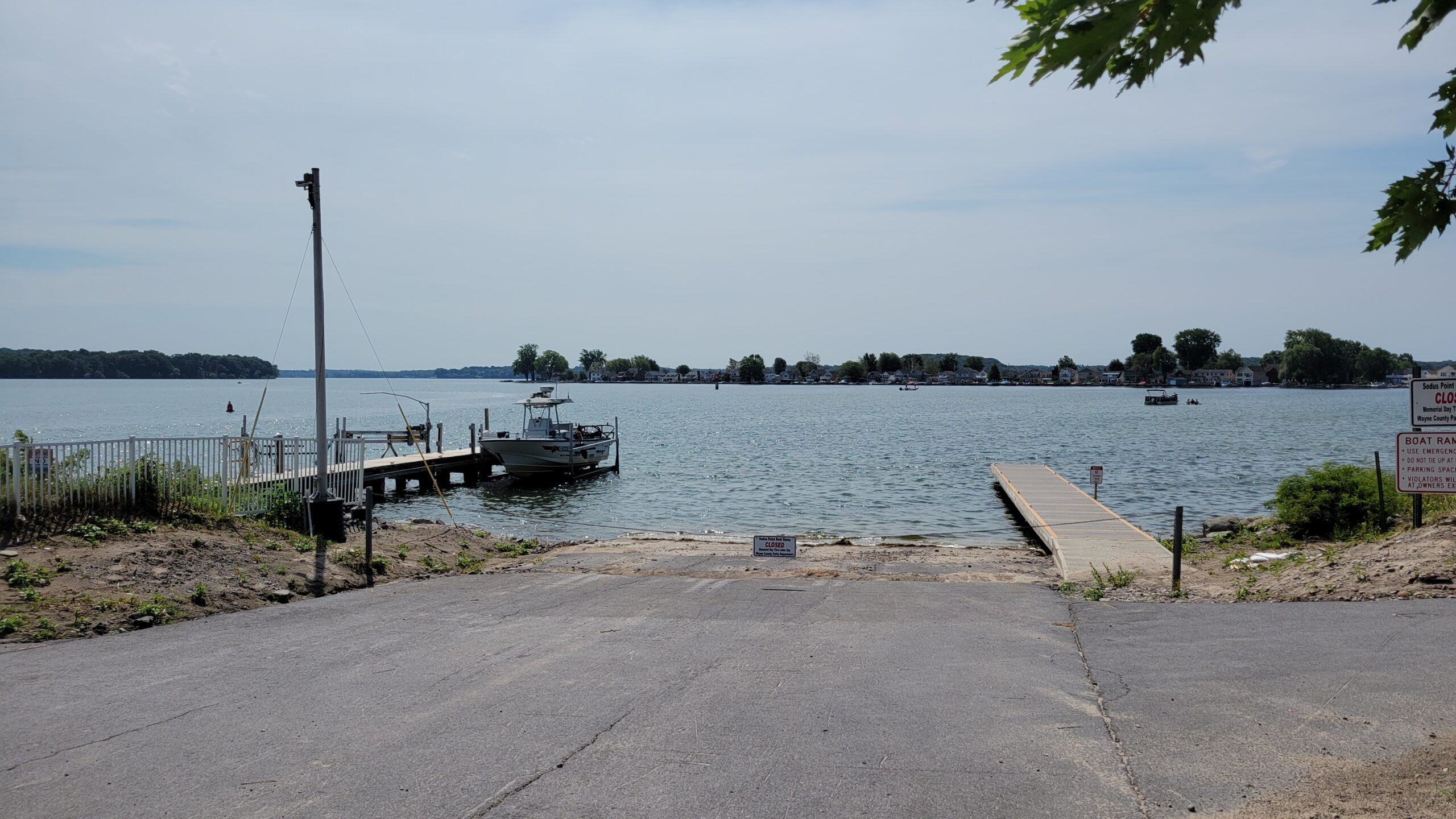
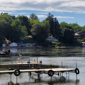
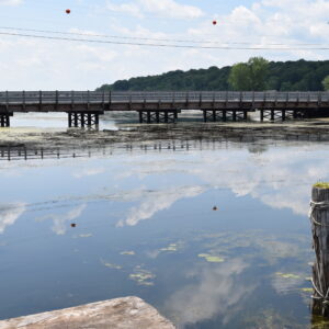
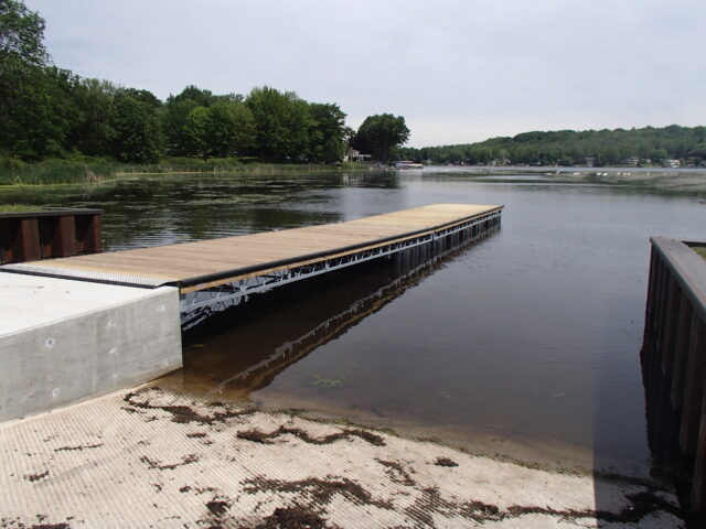
New York State Fishing Access Site’s new floating dock system at Port Bay South, June 2022

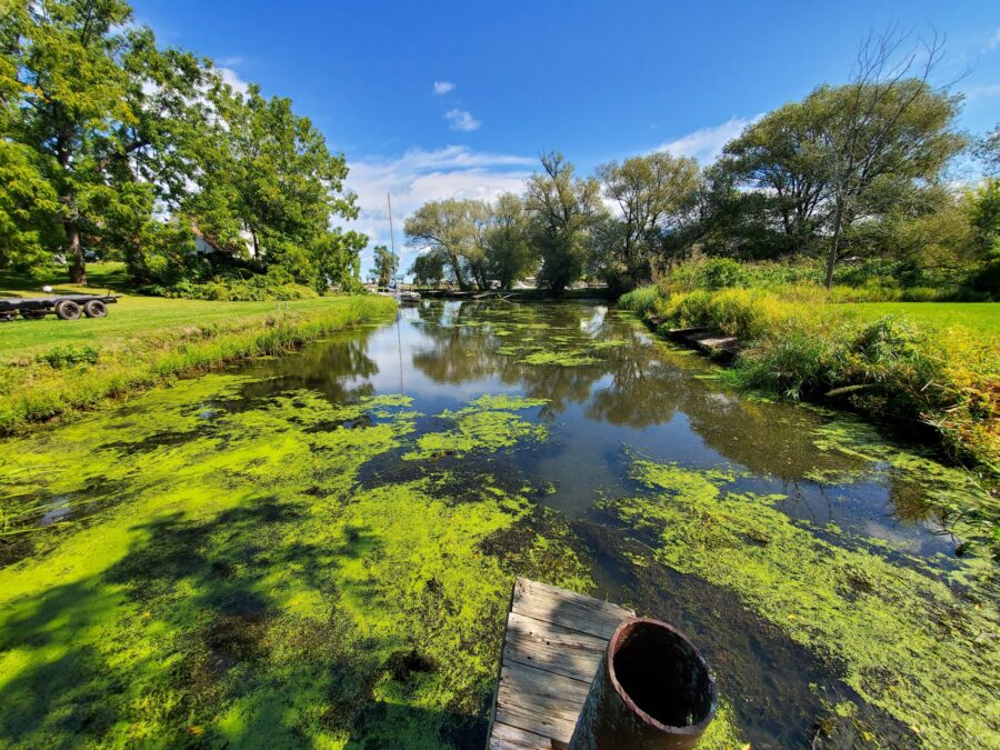
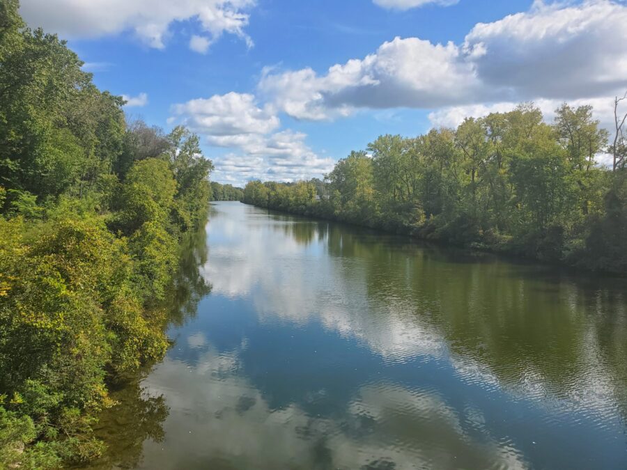
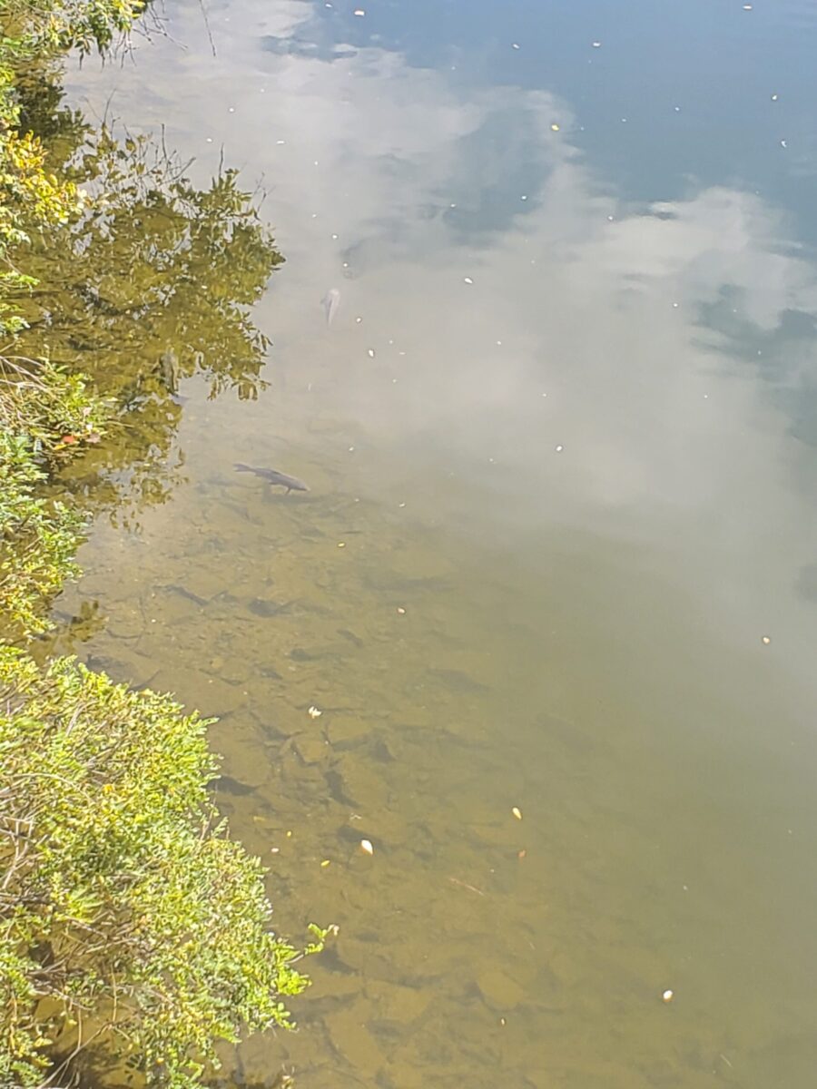
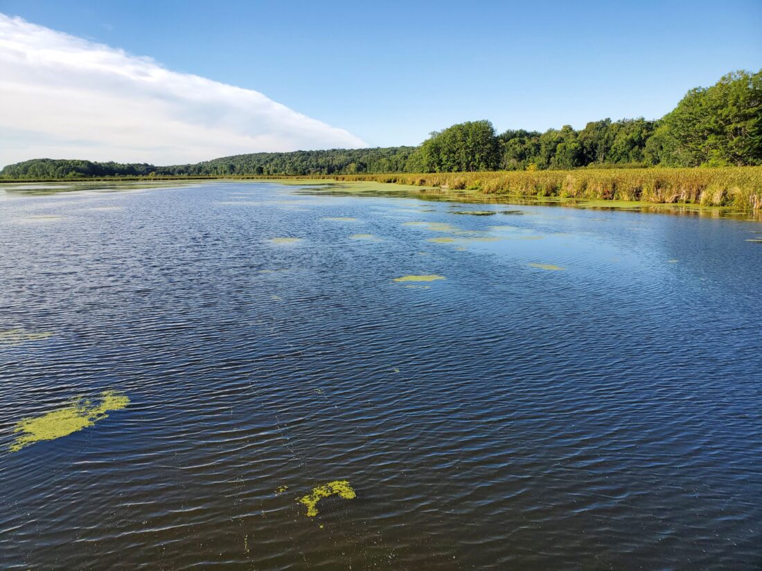
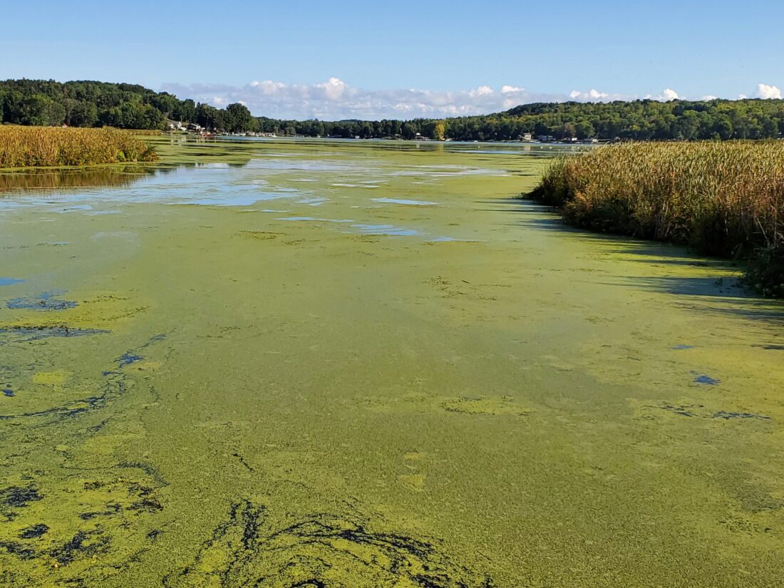
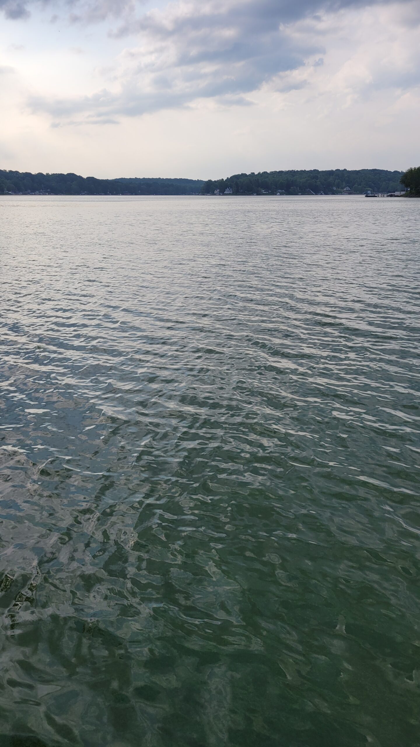
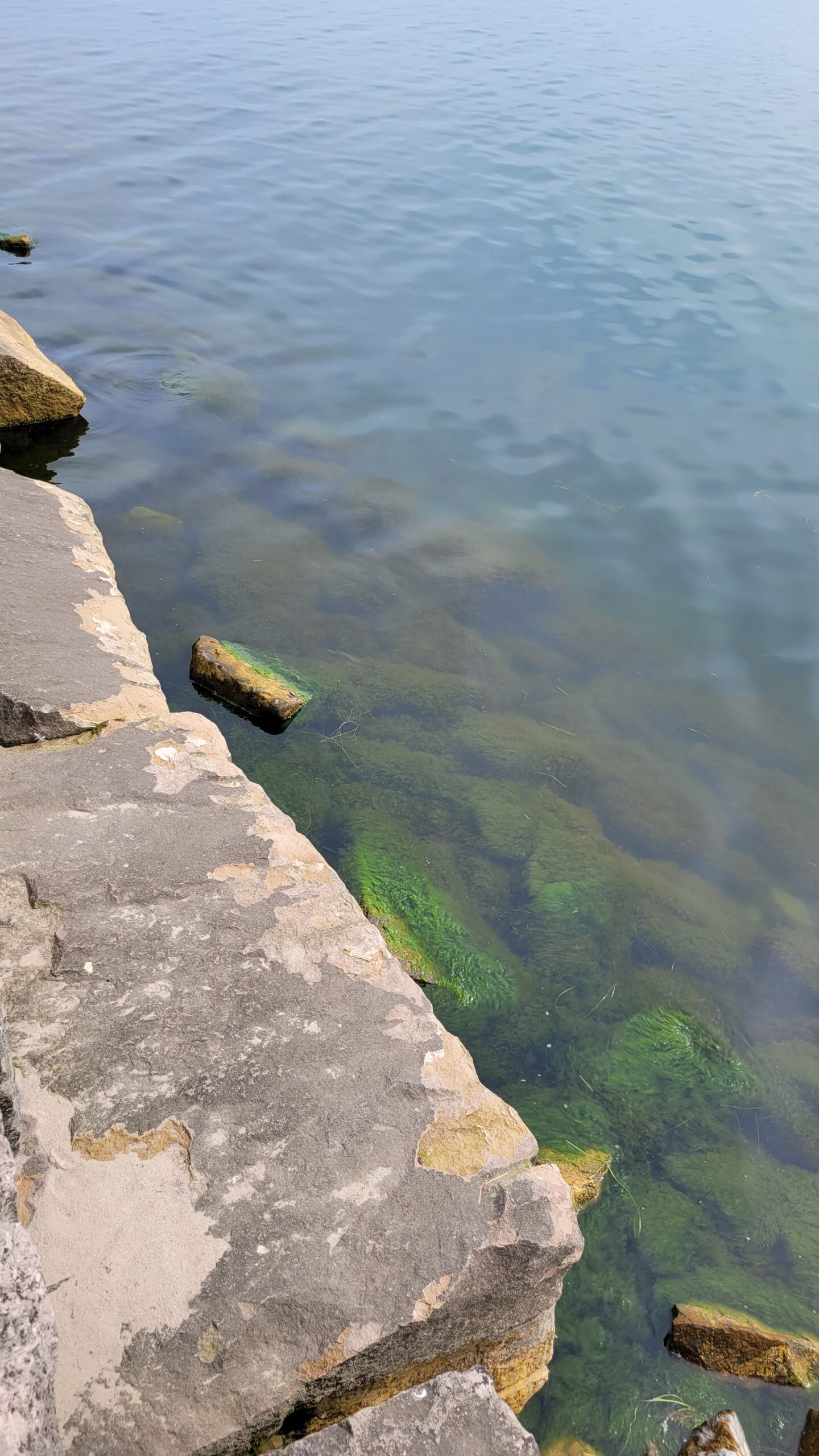
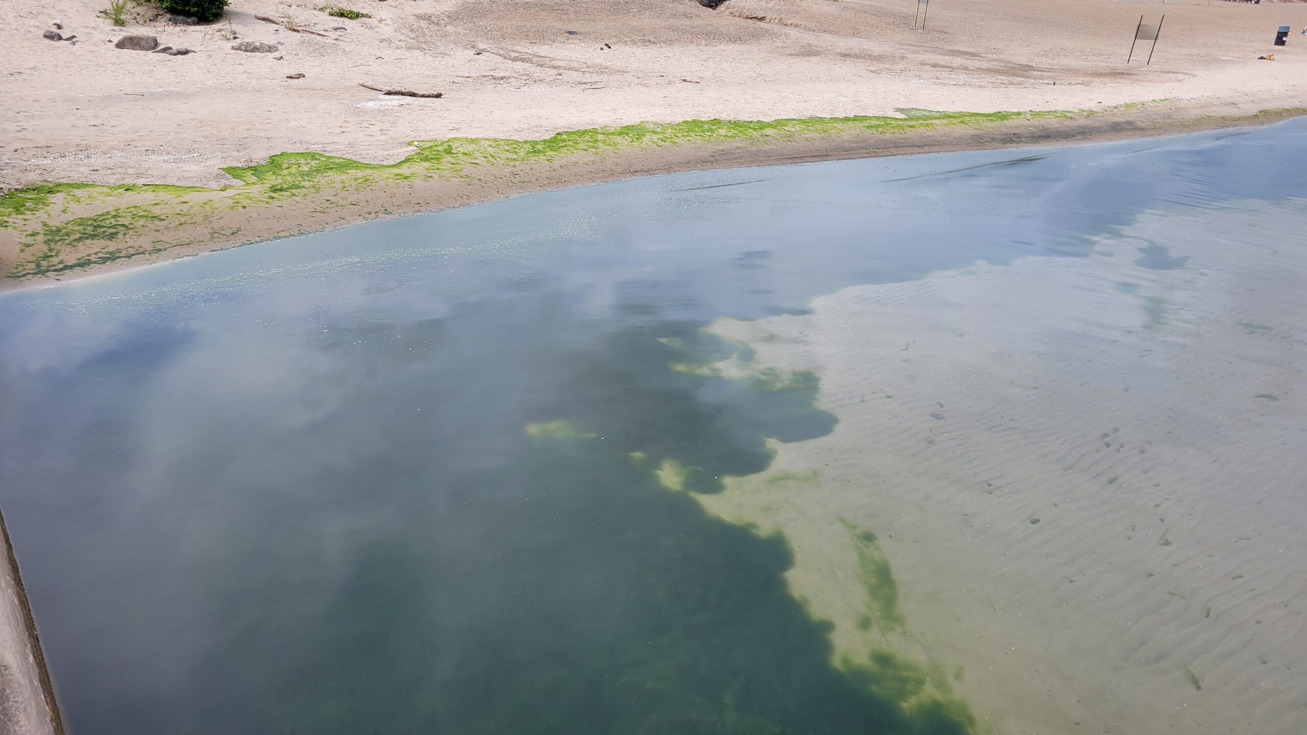
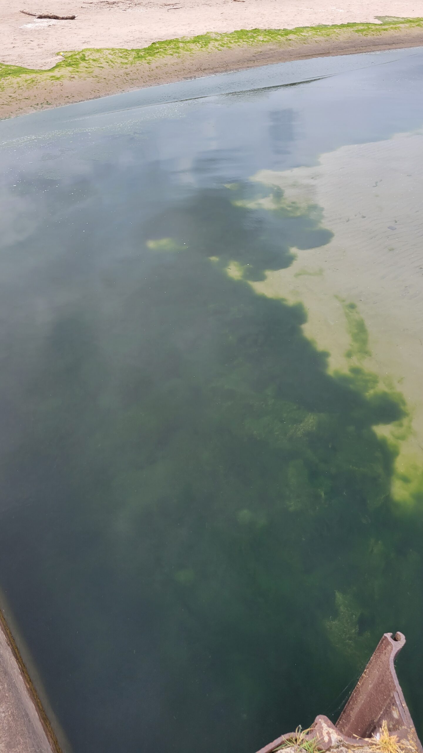
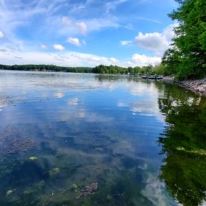
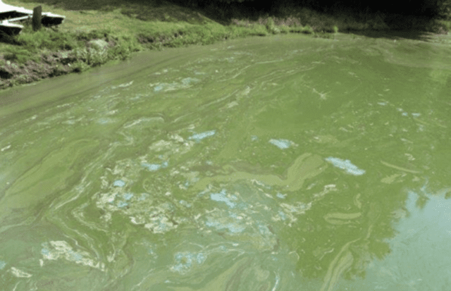
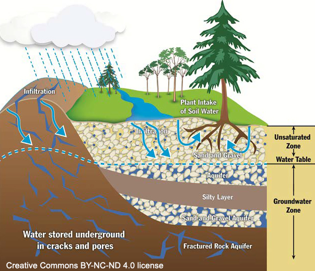
Water Quality continues to be a concern due to changing weather, and temperatures, through watershed management. Throughout the summer of 2022 until Columbus Day, District staff will be reviewing water quality and positing updates if there are specific concerns on the waterfronts and how to manage them throughout Wayne County.  Watersheds are the entire area that supplies water to a waterbody. This can potentially make up 1000s of acres of land with various topography, and use.  Water quality update reports will include descriptions based on weather patterns, temperature, what you are seeing in the water, invasive species and local water quality projects.

The District monitors water quality across Wayne County throughout the year and tried to address targeted issues that have been brought up by the communities. One of the positives from the COVID response was the District’s Landowner Assistance Program (LAP forms) and Municipal Assistance Program (MAP forms) that are available online to help target and narrow down issues. This form is fillable and allows the landowner or municipal leader to upload a request and photos in real time from our Website.

This report allows us to see where review is needed. The LAP/MAP program is for technical review by trained technicians. It is not a grant program.  The District staff will review the site through technical maps, permitting needs and water quality considerations and then will follow up with the requestor by email or by phone depending on the initial review findings. On a rare case, there may be a request for an on-site visit. This process may take 2-3 weeks depending on the amount of requests that come in at once.

The District’s Technical Staff is made up of 5 people that have made community water quality their professional career. They focus on the “bigger picture” of watershed management while working to address the water quality impacts of the local community.


Aquatic Vegetation Control aka Weed harvesting Summer 2022

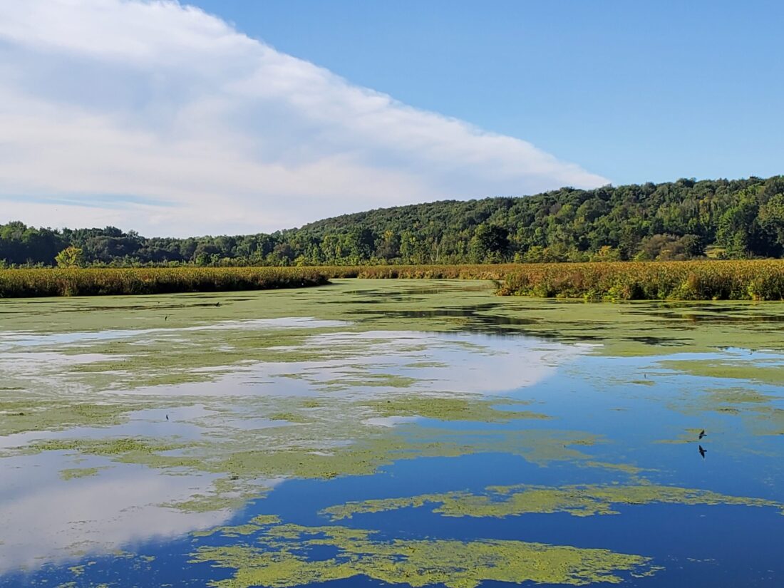
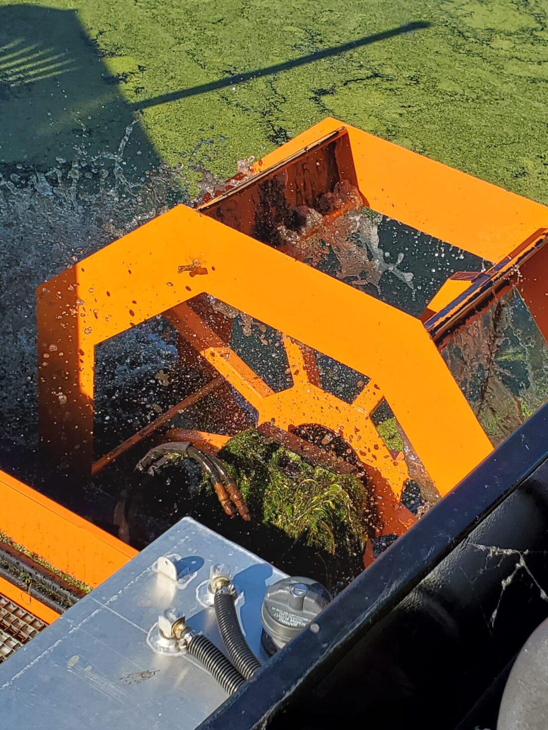
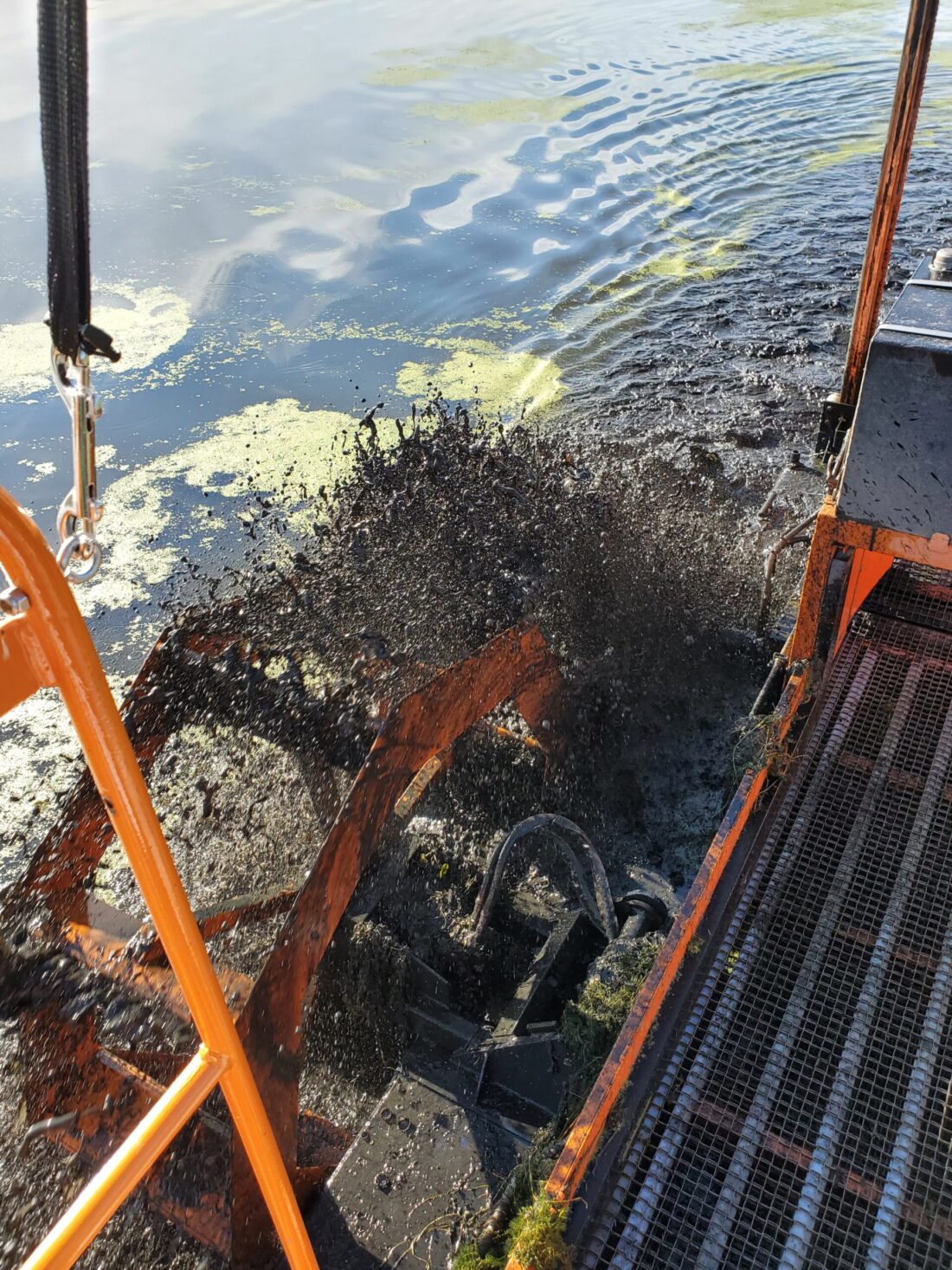
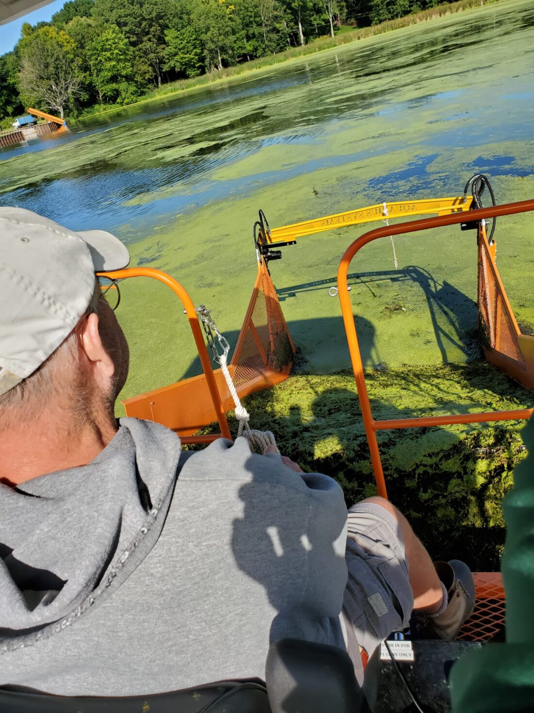
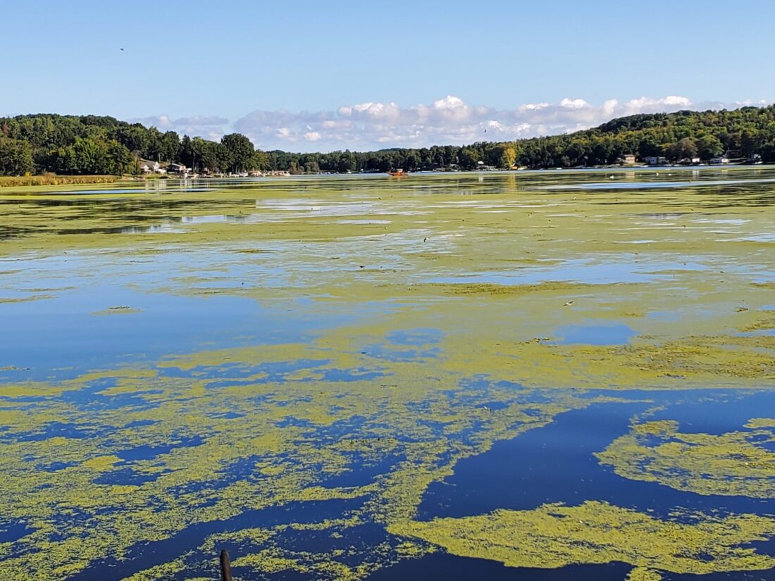
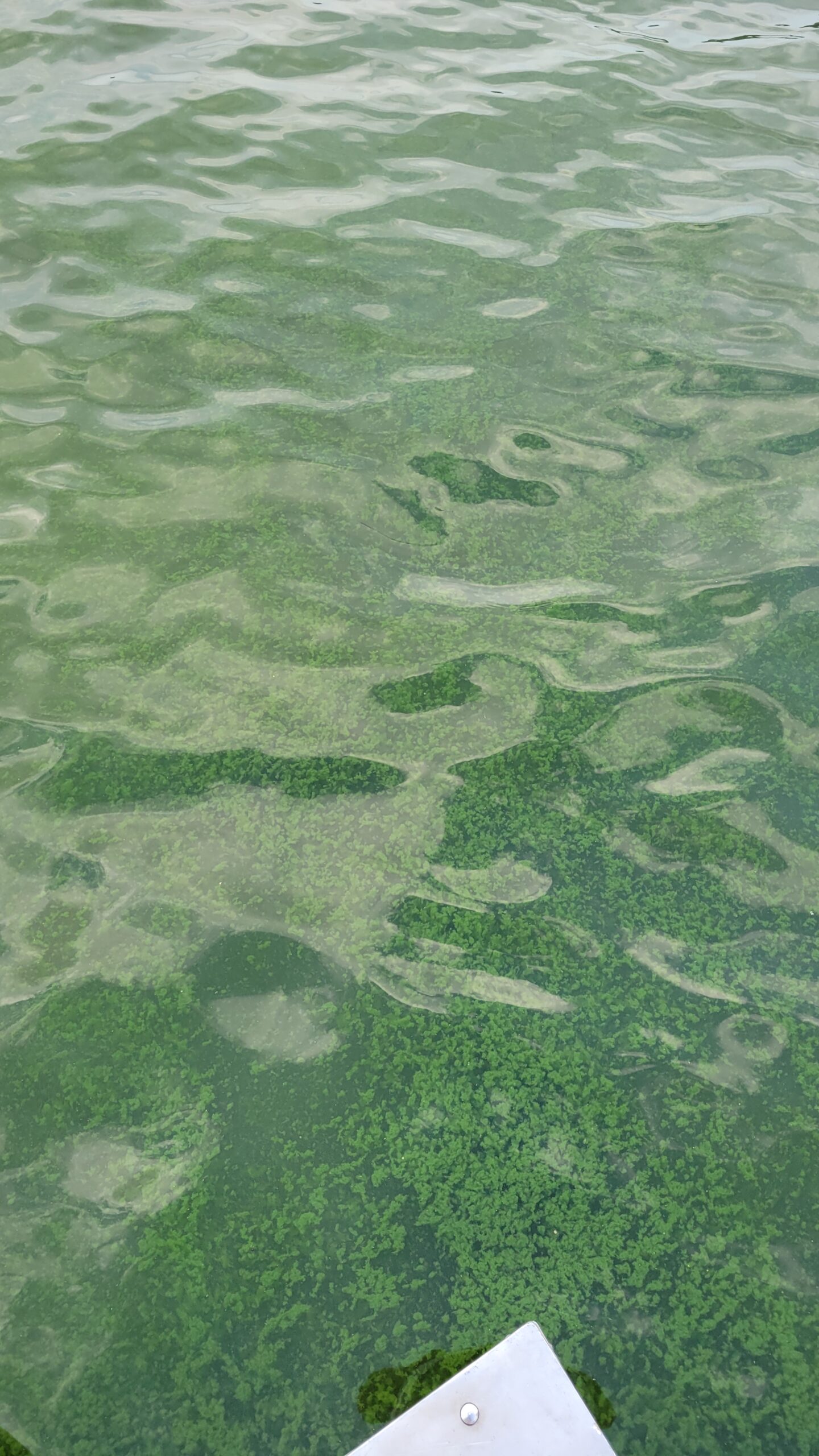
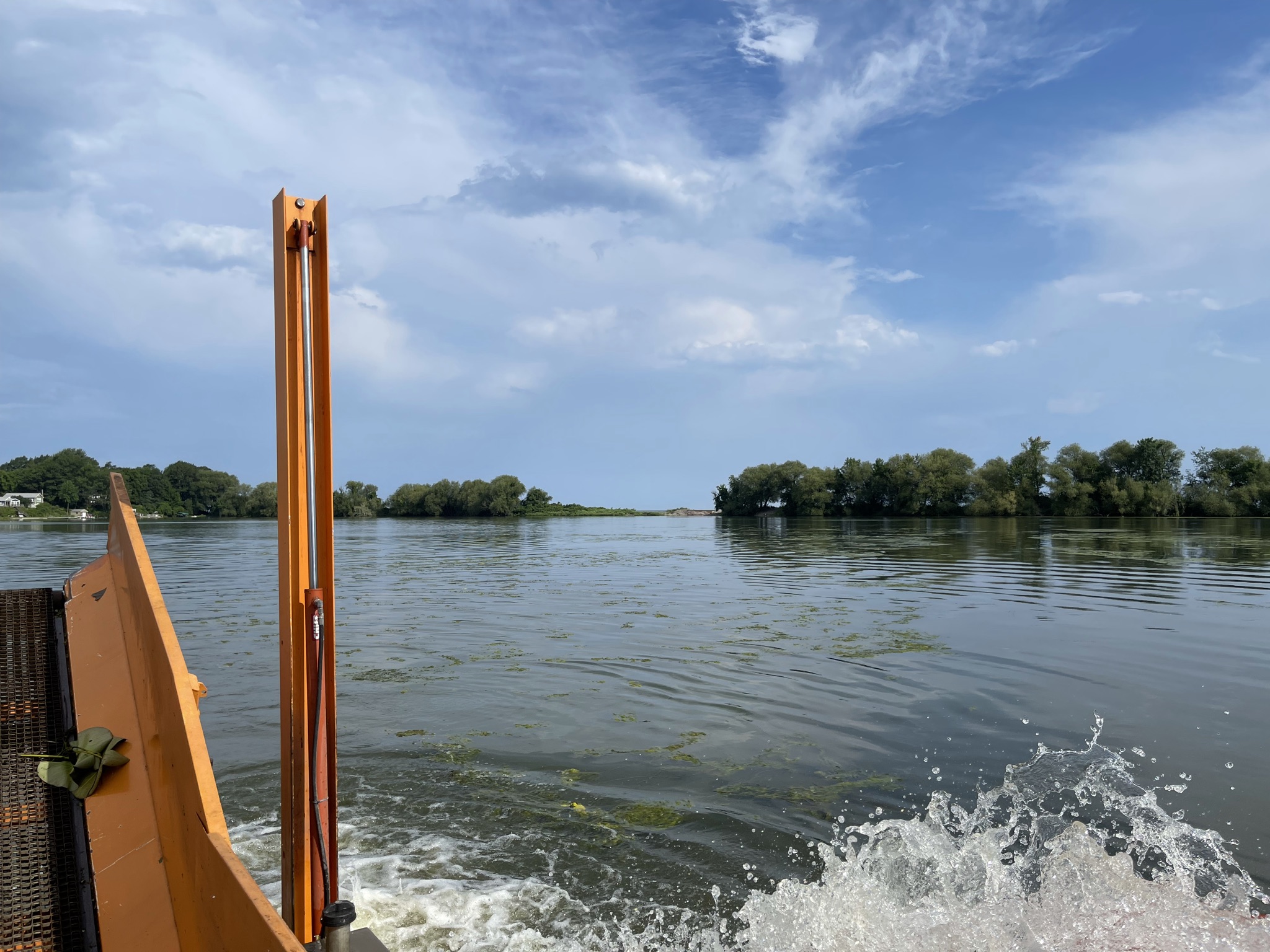
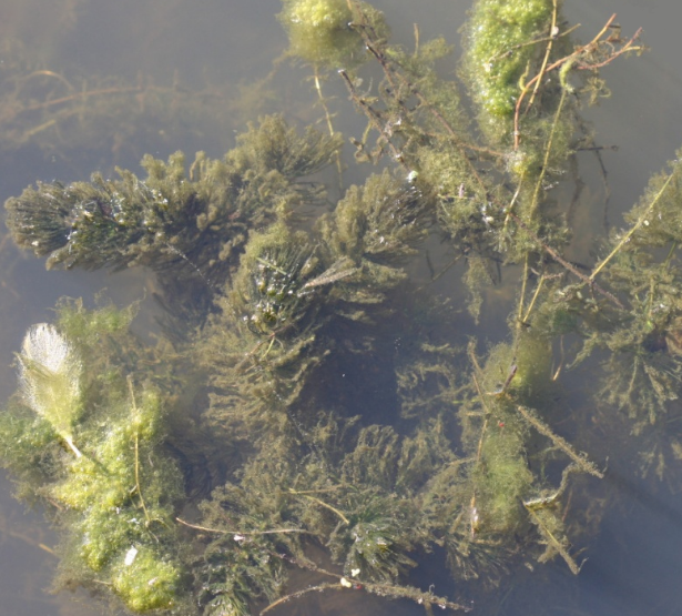
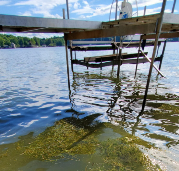
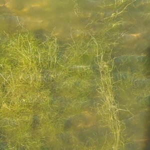
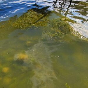
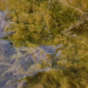
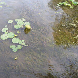
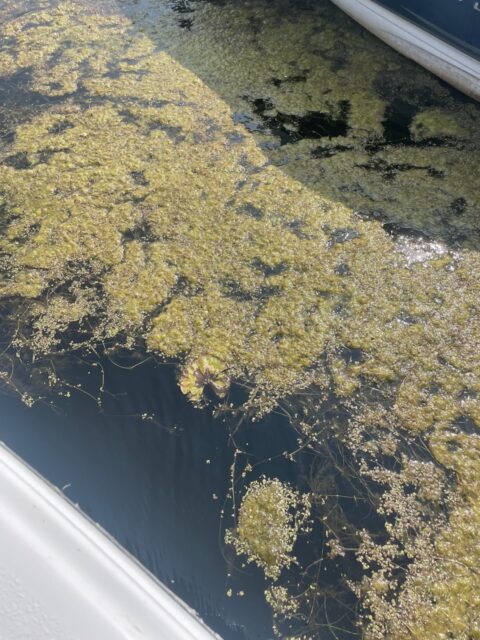
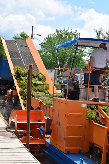
Aquatic Vegetation Control (AVC) is a form of nutrient management that is one of several management techniques used to manage non-point source water pollution that is natural but also impacts a balanced ecosystem for water quality. Selective harvesting invasive species and some high concentrations of water weeds verses letting them die off and fertilize seedbeds within a waterbody does three things for the environment:

      1. Removes nutrients from waterbody in specific areas to prevent high growth of stronger weeds;
  1. Reduces the potential for continuous spread of some highly invasive aquatic weeds like Water Chestnut;
  2. Increases flow from the outlets of streams into the waterbody to allow for regular movement of water thus preventing algal blooms.

There are other benefits to this management technique which include pathways for boaters to navigate into open waters, pathways for fisherman to access weed-beds for better fishing and better ascetics for the community. The District’s Aquatic Vegetation Control program subcontracted by Wayne County, began on June 13th and will provide 1 service to specific areas in 2022 through September 9th. The tentative schedule has been posted but is subject to change based on technical review weekly by the staff for addressing water quality impairments. Further schedule updates can be found on the District’s website.

For additional information on Invasive Species Management and the Aquatic Vegetation Control program please go to visit the AVC Program Webpage

Water Quality Update: 8/4/2022 Lake Ontario & Seasonal Change

The Water Quality remains pretty stable across the County with variable storm events that help to create more “flow” in the system which causes water movement and introduces more oxygen thus helping keep balance in the system with weed growth, fish & wildlife heartiness and algal blooms.   As far as water levels go, Lake Ontario predictions are pretty close to date. Upland streams and tributaries need to remain clear. If there are log jams that completely cross a stream system this can cause other flooding problems during storm events. Try and work out how to remove it by lopping it up or sliding it over to the bank.  However, some limbs or tree top branches in the stream create habitat for wildlife, help keep streams cooler and do help in some instances with bank stabilization and erosion.

Need technical assistance? Visit https://waynecountynysoilandwater.org/request-assistance/

Have a question specific question? Email Lindsey@WayneNYswcd.org or Maxine@WayneNYswcd.org


INFocus Groundwater Recharge on a Cold Raining Day in Wayne County

Water Cycle

These cold and rainy fall days may feel a little uncomfortable, but with the rain, the land is actually getting a “recharge.”  The land is coming out of a drought year. We need the aquifers refilled to maintain drinking water and long term watershed supply. When it rains, water does not stop moving when it hits the ground. Some water flows along the land into streams, bays, and lakes. Some water is used up by trees and plants and other water particles evaporate and return to the atmosphere which increases humidity and storm potential. Local forecasts keep changing for snow and precipitation projections but based on the water systematic increases, water increases the potential recycling within the local system.  It also provides opportunities to balance carbon and other important air quality effects from the local community and ecosystem.

Recharge and water supply from the fall perspective set up the local community to withstand the frost freeze changes during winter months.  Many storms like the last week, while consistent and bountiful, the 5 inches of average rain in the last week has helped elevate water tables, recharge many local wells and increase Lake Ontario’s water level during times of draw down to help balance shoreline levels. All surface water has a purpose and excess water seeps into the ground.

The water that seeps into the ground clings to particles of soil and plant roots just below the land surface that provide plants enough to grow. It also provides winter resiliency for the plants during hardening for healthy stock next year. The water not used by plants moves deeper into the ground and downward through empty spaces or cracks in the soil, sand, or rocks until it reaches a layer of rock through which water cannot easily move. This creates a reserve.   The top of the water in the soil, sand, or rocks is called the water table, and the water that fills the empty spaces and cracks is called the groundwater zone. Water seeping down from the land surface adds to the groundwater and is called recharge water. Maintaining good aquifer levels will support water storage for water treatment systems and irrigation for agricultural production, and the garden plants and trees.


Keep Leaves Away from Storm Drains

storm_drainsNow is the time of year to be conscious of the yard and garden clean-up. Make sure you keep leaves and grass out of storm drains.  Fallen leaves and grass clippings can plug storm drains and can cause flooding to our roadways.  If yard waste such as leaves, grass clippings, and small twigs are disposed of in a storm drain, they will make their way to a natural body of water where they threaten aquatic life and degrade water quality.

Don’t feel obligated to rake up every last leaf in your yard this fall. Let some leaves stay on the ground — they have many benefits to wildlife and the garden. A composting-leavesleaf layer sometimes called duff, several inches deep is natural on forest floors. This leaf layer is its own mini-ecosystem! Many wildlife species live in or rely on the leaf layer to find food like earthworms and other beneficial microbes.

From a gardening perspective, fallen leaves offer a double benefit. Leaves will form a natural mulch that helps suppress weeds and at the same time fertilize the soil as they break down. Why spend money on mulch and fertilizer when you can make your own? Here is a great video on how to create leaf mold, it takes a few years, but it is considered garden gold. Farmer’s Almanac  page.

If leaves must be racked, don’t throw them in the trash. Compost them or drop them off at a municipal recycling center so they can be turned into compost that you and other members of your community can use in the spring. Some communities even offer curb-side pick up of leaves specifically for municipal composting operations.

  1. Leaves make good insulation for overwintering tender perennials. The best time to mulch perennials is after the ground has frozen, so put aside shredded leaves in bags to use later in the fall.
  2. Mow leaves and clippings into the lawn, lawns actually benefit from thin layers of leaves. Leaf litter improves the soil, lessening the need for fertilizer in the spring.
  3. Leaf humus can lighten heavy clay soils, so leave a layer in the garden.
  4. Leaves increase the moisture retention of dry, sandy soils.

The Wayne County Master Gardeners can offer more information, visit http://ccewayne.org/gardening-home-grounds

Happy Raking!


Blind Sodus Bay and Port Bay REDI Project Updates Available

Port Bay, Wayne County NY

In response to the extended pattern of flooding along the shores of Lake Ontario and the St. Lawrence River, the Resiliency & Economic Development Initiative (REDI) was created to increase the resilience of shoreline communities and bolster economic development in the region. Wayne County in partnership with the New York State REDI program has committed to working together on addressing resiliency shoreline issues and has been in the process of choosing priority projects across the County since June 2019. The Wayne County Project Profiles provides a full overview of the projects chosen for Wayne County.

Wayne County Soil & Water Conservation District (WCSWCD) is working in collaboration with Wayne County as a general contractor to address shoreline resiliency needs for the Port Bay Barrier Bar System and the Blind Sodus Bay Bluff and Barrier Bar System.

The District is pleased to announce project information and updates are now available.  Updates include project history, story maps, engineering design reports, project profiles, SEQR reports, and more.

Follow these links to the project reports:

REDI Project Updates

      • Project Overview
      • BLIND SODUS BAY, Bluff and Barrier Bar System – WCSWCD collaborating with Wayne County as a general contractor
      • PORT BAY, Barrier Bar System – WCSWCD collaborating with Wayne County as a general contractor

At the bottom of the two project pages, there is a way for the public to make comments. The District hopes a 90% project report will be released by the end of the year.

Water Quality Awareness Week of 9-16-2021

Unfortunately with stronger storm events from the northeast and then rotational North West winds are causing much of the breakoff in all of the waterways in Wayne County. This includes the bays, the canal system, tributaries, and their outlets.  In this week’s water quality review, you can definitely see a change in the water quality including observations like striation of the water columns, increased breakoff, and collection around infrastructure and in cove areas.  While the sediment is being pushed around by the wind, the deeper area is still seeing some algae growth. The potential for blooms is lower due to the cooler temperatures and the increased movement of waves.

It was also noted as more shoreline starts to show, stormwater runoff and collection is being affected because the balance of the below-ground aquifers have changed. This allows a variation in pressure in the watershed. This is what is referred to as a change in Hydrology.  Due to hydrology variances, there is a potential to see water where it hasn’t been seen before.  Along with seeing wildlife, fish, and birds in other places in the waterways where they haven’t been before.

Lake Ontario water levels have been fairly stable for the last week about 245.3- 245.4 depending on seiche events due to weather. ( see weekly summary)

NYS REDI Initiative dredging was finishing up in Pultneyville Harbor and Bear Creek Harbor this week.

Floating Duckweed & Water Levels Highlight this Week Water Awareness 9-9-2021

Water levels are beginning to taper off with an average at 245.35 at local south shore Lake Ontario stations this week and will be losing a few more inches of water on Lake Ontario in the next few weeks according to US Army Corps of Engineer projections. Click here for USACE Forecast

Local water levels on bays will continue to be low and will increase and decrease from upland watershed flows and wind events which will last up to 36 hours before calming.  Monitor boat slips, and other watercraft regularly.   Wind events in the last two weeks have been the culprit for surface weed exposure, creating floating bogs and break off.

Floating Duckweed can help alert boaters to areas of weed concentration as the Duckweed collects at the surface. Shown in the photos below.  This time of year, weed populations are dying off due to the cooler temperatures and the increased disturbance from wind/rain events. (click on images for larger view)

The SWCD Weed harvesting program continues to address weed mats and floating areas.  This year’s focus has been on flow and circulation as many of the areas are too shallow to adequately access fully loaded.  The last week, the Crew has focused on South of Port Bay area, closest to Wolcott Creek Inlet to open up water flow for the fall and winter season.  The crew is going to make its way north and clear out the cove areas on Port Bay after surface control of breakoff mats from this last week’s storms and back to Sodus Bay to address areas where collection mats have floated into tributary outlets and coves.

Water Quality Awareness update August 13th-26th

Sw

Second Creek increased streamflow. This is an important part of a natural cycle because of its impact on water quality and the living organisms and habitat in our streams.

As we enter the final week of August, we can see the end of summer just around the corner. All of the recent precipitation has provided a stark contrast to the weather from May and June. Over the past two weeks, we have seen the aftermath of tropical storm Fred and additional passing showers from Hurricane Henri’.

Rainstorms are categorized by their rainfall intensity and frequency of occurrence. This is determined by calculating the amount of rainfall per hour, or the total rainfall for a 24-hour period. For example, in Wayne County, a one-year storm event will drop 1.9” of rain over 24 hours, whereas a 100-year storm will provide between 5” to 5.5” of rain for the same time period. The intensity is the amount of rain falling and the frequency is listed as the 1-year or 100-year storm. The frequency represents the probability that a storm of that magnitude will occur. In other words, it is a safe bet that Wayne County will receive a storm that drops at least 1.9” of rain over a 24 period, or 0.08” in an hour. On the other hand, there is a 1% chance (1/100) that a storm will drop at least 5” of rain over a 24-hour period. Between 1” – 1.5” of rain was forecasted to fall throughout the County on the 18th. Lyons received nearly 3” of rain over the course of the day, which puts last week’s storm at about a 10-year storm event for the region. This high-flow rain event had an immediate impact on our local streams and rivers.

FL PRISM – NYS Parks On Water Chestnut Awareness Event – Hand Harvesting Water Chestnut – Black Creek

In other news, Wayne County wrapped up its Water Chestnut hand pull season on Friday, August 13th. A patchwork crew from FL-PRISM and NYS-PRHP (Parks) surveyed a new location within the Black Creek Unit of DEC’s Lake Shore Marshes Wildlife Management Area. The crew of seven had to carry kayaks 1/2 mile to and from the hand launch due to a fallen tree blocking the access road. 1.25 miles of stream corridor was surveyed, and a small population of water chestnut was found towards the end of the stream. The infestation was documented, and all the invasive plants were removed from the wetland within an hour of finding them. After reporting to NYSDEC, it was determined that this will be a targeted area for next year’s management efforts.

At first glance, this event may seem insignificant, but it highlights some critical points for invasive species control. First and foremost, the working partnerships between agencies are critical for keeping up with landscape-wide surveying and management. Secondly, since this infestation is relatively small, this site is a great candidate for eradication with one to two annual management events.

Wayne County Soil and Water Conservation District has hosted five water chestnut awareness events this season. Work was done in 4 locations with 75 people, 21 hours on the water hand pulling and surveying for this invasive species.

At the end of the day, the District and Partners covered over 4 miles of streams and removed ~2650 lbs. of water chestnut.