Archives for July 2017

Water Chestnut Handpull – We need volunteers

NEW DATES, EXTRA HAND PULLS – JOIN US!

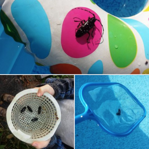
“Come spend a morning on the water and help us remove invasive water chestnuts from our local bays and streams. Volunteer Hours Available. Please contact our office for more information about signing up or scheduling an event.”  315-946-7200

August 3rd Lake Shore Marsh, the very end of Sodus Bay 9:00 A.M. (click for more details & map)
August 10th Emerald Drive 2nd Creek , follow Emerald Drive to the end. (click for more details & map)

Empire Farm Days – Aug. 8-10

You’ll be hoisting hoods, climbing into cabs and taking tractors, trucks, applicators, UTVs or construction equipment for a test spin. You’ll be loading up on equipment and services information for later study, and of course, hitting the food tents. It’s all part of  experience, Aug. 8-10 at 2973 State Route 414 on the south edge of Seneca Falls.

For a full schedule click here http://empirefarmdays.com/

DEC Announces Statewide Asian Longhorned Beetle Outreach and Survey

The New York State Department of Environmental Conservation (DEC) today announced that the annual Asian longhorned beetle (ALB) Swimming Pool Survey is underway, marking the program’s sixth summer of research work.

DEC invites pool owners, now through August 30, to check their pool filters and help keep watch for these invasive beetles before they cause serious damage to the State’s forests and street trees. DEC and partners will also be hanging tags on host trees to encourage people to learn more about ALB and to demonstrate the potential impacts in neighborhoods and parks.

More Information can be found here http://www.dec.ny.gov/press/110853.html

Mark your barrels with an X – Help USCG

The U.S. Coast Guard needs your assistance!

With the increased water levels throughout the region, and along Lake Ontario and its tributaries in particular, many homeowners are using barrels such as these to mark their docks and assist in weighing them down, an understandable thing to do and one that helps also by increasing the safety of the waterway by helping mark potential hazards posed by otherwise submerged/unseen docks.

What homeowners probably do not realize is that if these barrels are swept off docks and float away, they then become a concern that the Coast Guard has to dedicate time, money and resources to recover.

Once adrift and if unmarked, by law, the Coast Guard has to classify such drums as “Mystery Drums” because contents are unknown and could possibly contain dangerous chemical or petroleum products. Significant diligence is required in processing these sorts of unidentified containers, up to and including the services of a hazardous material contractor to recover the drum out of the waterway and verify there is no risk to the public or environment from the contents – at costs that may exceed $5000 per drum.
Additionally, Coast Guard personnel are required to stay on scene with the mystery drum, thus taking away an asset from other local emergency responses.

We are requesting homeowners assist us in marking barrels they have placed on their docks by painting or marking a large red “X” on the drum so that Coast Guard crews can quickly identify it as a non-hazardous dock drum and allow its origin/contents to be resolved without the need of further specialized investigation. This will also allow Coast Guard boats and people to be available for pressing search and rescue or other maritime emergency cases in the region, continuing our tradition of service to the public.

Any questions can be answered via phone at the Sector Buffalo Command Center (716) 843-9527.

Thank you for your assistance.

07-07-2017 Sodus Bay Blue Green Algal Report

USGS Scientists to Track Effects of Historic Lake Ontario Flooding

Beginning July 10, U.S. Geological Survey scientists plan to conduct fieldwork along a flood-impacted stretch of New York’s Lake Ontario shoreline, using unmanned aerial systems (also known as drones), pressure sensors that measure water elevation and special water-elevation gages designed for rapid set-up. The fieldwork, supported by the state of New York and the Federal Emergency Management Agency, is designed to gather up-to-date information to help emergency managers track and respond to historic levels of flooding, and to collect new scientific data about coastal processes affecting the lake’s shoreline.

High waters on Lake Ontario and the St. Lawrence River have damaged hundreds of residential and commercial properties along the shoreline, leading New York Gov. Andrew Cuomo to declare a state of emergency in six counties around the lake. The flooding was caused by heavy rains that fell on the Lake Ontario basin, a 32,000-square-mile area that stretches between the U.S. and Canada, in April and May. The Army Corps of Engineers estimated that roughly four trillion gallons of rain water has flowed into Lake Ontario. The lake is now more than 30 inches above normal, the highest it has been since at least the 1950s.

Photo: (USGS pilots land a quadcopter drone after obtaining images for mapping Town Neck Beach in Sandwich, Massachusetts. Credit: USGS, public domain)

“This hasn’t happened in nearly a generation, so state emergency managers have not had to respond to an event of this magnitude in the era of modern science and technology,” said E. Robert Thieler, director of the USGS’ Woods Hole Coastal and Marine Science Center, which is collaborating with the USGS’ New York Water Science Center in this effort. “We will provide information and tools we’ve developed while working on ocean coast hazards, so that the state can have access to the latest science to inform their decision making.”

Hydrologists from the USGS’ New York Water Science Center will install 14 water-elevation measuring devices along a 150-mile stretch of shoreline stretching south of Watertown, New York. The gear includes eight rapid deployment gauges, which measure water elevation using radar, and six water-pressure sensors, which are anchored below the surface and use the amount of water pressure on the device as a way to calculate water elevation. Information from these sensors will supplement data from the National Oceanic and Atmospheric Administration’s existing lake-elevation network. The scientists will also measure and record high water marks—the telltale lines left by seeds, weeds and leaves on buildings, bridges, trees and bluffs.

“We will use the data we’re collecting to determine the exact extent, depth and duration of the flooding,” said Robert Breault, director of the USGS New York Water Science Center. “The information will also help us better understand flooding and wave dynamics that, in turn, will help us build more resilient coastal communities.”

Working with the New York-based teams, crews from the Woods Hole, Massachusetts center will fly an unmanned quadcopter about the size of a pizza box over at least two shoreline areas: the Braddock Bay Wildlife Management Area near the town of Greece, New York; and Sodus Bay, between Rochester and Syracuse, New York. Flying at around 160 to 300 feet above ground level, the quadcopter will take hundreds of photographs of individual shoreline features. Before each quadcopter overflight, field crews will deploy black and white targets as reference points in the photographs. USGS experts will then use computer “structure from motion” software, similar to that used in some 3D gaming apps, to analyze stereo views in those photographs as a basis for detailed shoreline mapping.

“It’s seriously computer intensive work that allows us to quickly develop a 3D elevation model of the coast,” Thieler said. “With that in hand, we can model beach erosion, vegetation changes, and a variety of other flood effects.”

That information will help the New York Department of Environmental Conservation and the New York Department of State understand coastal changes taking place in the wake of this flood, and plan for any future flooding, Breault and Thieler said.

Media Alert: Reporters wishing to accompany USGS scientists in the field the week of July 10 should contact Bill Coon, 607-220-6280 or wcoon@usgs.gov by 5 pm EDT Friday, July 7.


Follow us on Facebook & Instagram